Three months after the Iwate-Miyagi Nairiku Earthquake struck the northern part of Honshu, Japan’s main island, on June 14, 2008, triggering a huge landslide above Aratozawa Dam, the site looked like a careless barber had given it a bad haircut; the area had been further carved up by snow and rain, and trees and other vegetation were in disarray.
According to Japan’s National Institute for Land and Infrastructure Management (NILIM), the epicentre of the 7.2 magnitude quake was near Mount Kurikoma, in north-eastern Honshu, and in the close vicinity of 15 dams, one of which was still under construction.
In this landscape carved by rivers, a landslide with an average depth of 55 metres, a width of 810 metres, and a length of 1400 metres, slid as far as 140 metres into the back of the lake formed by the dam.
A few days after the earthquake, Tokyo University professor Konagai Kazuo appeared on NHK television’s Close-up Gendai special, “The Mountain that Disappeared: The Iwate-Miyagi Nairiku Earthquake”. He explained that, because ground water near the dam was high and snowmelt had permeated the ground, the violent shaking of the earthquake had caused the massive landslide.
As highlighted by events at Aratozawa, many dams should never have been built where they were: where the volcanic character of the soil can cause huge landslides. In addition to the Aratozawa Dam, which was constructed by the agriculture ministry, landslides have occurred while reservoirs were being filled at the Japan Water Agency’s (JWA) Magio Dam and Takizawa Dam, both in central Honshu and at the Ministry of Land, Infrastructure, Transport and Tourism’s (MLIT) Ōtaki Dam, in southern Honshu.
What connects all of these landslides is the immense, and seemingly never-ending, cost of dealing with them. What is even more amazing is that, despite these numerous examples, the government seems intent on going ahead with other dam projects, such as the Asakawa Dam in the Chūbu region of central Honshu.
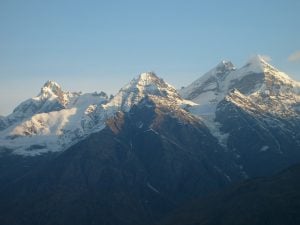
About an hour by car from the office blocks of Kurihara city, beyond golden rice fields, one can see patches of bare rock in the distance. Mount Kurikoma, with an elevation of 1,627 metres, looks gentle, but this ancient volcano erupted as recently as 1950.
According to documents from the Japan Meteorological Agency, a series of earthquakes rocked the area in 1957, 1985, and 1986 and, in the month before the big one in June 2008, 22 tremors shook the mountain. Professor Kaneori Yuji, leader of a research team from Yamaguchi University and the Geological Society of Japan, explains that “when magma moves below a volcano, earthquakes occur.” On the earthquake archipelago of Japan, it is no surprise that tremors are frequent in the vicinity of volcanoes.
According to the Yamaguchi research team, the soil of Mount Kurikoma is mainly composed of tuff, deposited there some 15 million years ago, mixed with volcanic rock. The peak is a volcanic heap and was probably susceptible to landslides before the earthquake occurred. Kaneori adds that the tuff, which is consolidated volcanic ash, collapsed easily because it contained many fissures that filled up with water. The geological composition, along with the tremor, led to the massive landslide.
The human costs were tremendous; the earthquake killed 13 people, left 10 missing, and injured 450. Damage to property was also extensive. The holding capacity of the Aratozawa Dam, which was completed in 1997, was to be 12.5 million cubic metres. Twice as much soil — 1.5 million cubic metres — slid into the basin as was to be removed. According to a spokesperson for the Tohoku office of MLIT, the cost of just removing the soil on the front edge of the slide would total around 38 billion yen (US$415 million).
Other than the Aratozawa Dam, there was considerable damage elsewhere in the area around Mount Kurikoma. Another slope slid into a neighbouring creek and buried a small valley, including the spot where the Kurikoma Hotspring Resort once stood, resulting in a number of deaths. Cracks also appeared in more than half of the surrounding 14 dams.
The prospect of a complete recovery is dim. The projected cost of repairs to agricultural, forestry, and water resources alone totals 133 billion yen ($US1.5 billion) and is estimated to take at least 10 years.
There are clear precedents for volcanic mountains collapsing because of earthquakes, leading to many casualties in areas around dams, and for dealing with these disasters to take many years and be hugely expensive. On September 14, 1984, the 6.8 magnitude Nagano Seibu Earthquake caused the collapse of the south face of Mount Ontake, sending about 9.6 million cubic metres of earth into the Ōtaki River. Towards Magio Dam, a pine forested area slid into the reservoir, carrying with it a number of homes and tearing a road in half. Twenty-nine people died or went missing.
In the years that followed, material that had slipped into the bottom of the river continued to flow downstream into the basin behind the dam. By 1992, the total amount of debris had climbed to 108 million cubic metres, and by 2000 it had increased by 1.5 times. Removing this debris to restore the water storage capacity of the dam cost no less than 30 billion yen (US$328 million) between 1995 and 2006.
Many people believe that the Nagano Seibu Earthquake was a “dam-caused quake”. It is recognised elsewhere in the world that structures such as the Hoover Dam in the United States and the Koyna Dam in India have contributed to earthquakes, and researchers have investigated this possibility in Japan as well.
In 1974, Ōtake Mazukasu of Japan’s Building Research Institute calculated the number of tremors in the area around Kurobe Dam and discovered a correlation between the height of the water and earthquake activity. Later, he conducted an experiment where he pumped 2,000 tonnes of water into a well in the Matsushiro area of Nagano Prefecture and found a relationship between water pressure and the occurrence of earthquakes. After conducting a study of earthquake data from 42 dams between 1926 and 1983, supplied by the Japan Meteorological Agency, Ōtake concluded that at eight dams, including Magio, earthquakes had increased after reservoirs had been filled.
In March 1995, the Japanese parliament finally held a hearing on the issue. However the construction ministry, now part of MLIT, did not accept the idea of dam-induced earthquakes. An inquiry into the issue concluded that “in Japan, a causal relationship between the level of water behind dams and earthquakes has not been clearly confirmed.”
Yet, even a JWA official acknowledged that, in the case of the Magio Dam, “earthquakes began as soon as it was completed”. When I visited Ōtaki village, the epicentre of the earthquake, many residents were not surprised that a landslide triggered by the earthquake had buried the dam.
In 2004, Ōka Yukio, the director of Ōtaki Community Centre, gave me a tour of the devastated landslide area. “Previously earthquakes did not occur in Ōtaki,” he told me. “But once the Magio Dam was built, the earth began to shake.” The dam was completed in 1961 and in 1976 a series of tremors occurred. Then, in October 1979, Mount Otake, which had never exhibited any volcanic activity, erupted.
“When smoke rose from the peak, many people thought that someone had accidently lit the hut on the top of the mountain on fire,” Oka recalled. Such a reaction illustrates how surprised local residents were by the eruptions and earthquakes. “Now every year when the snow melts, and the dam fills with water, there are earthquakes,” said Ōka. “It certainly seems like there is some sort of causal relationship.”
Masano Atsuko is a journalist specializing in environmental issues.
An earlier version of this article appeared in Sekai in December 2008 and was later published as “The Immense Cost of Japanese Dams and Dam-related Landslides and Earthquakes,” The Asia-Pacific Journal, 1-2-10, January 4, 2010, translated from Japanese into English by Aaron Skabelund. It is used here with permission.
Homepage image by komoda
NEXT: A lesson in government failure