
Yang Yong is an independent geologist and director of the Hengduan Mountain Research Institute.
Liu Qin (LQ): What evidence is there linking the Ludian earthquake with hydropower development?
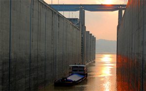
Yang Yong (YY): Currently we just need to take the basic facts seriously – the epicentre of the latest Ludian earthquake was in the Niulan River valley, and the Niulan is a tributary to the Jinsha. It was less than 7 kilometres away from Tianhuaban, the seventh dam in the Niulan cascade and just 10 kilometres from the Xiluodu Dam on the Jinsha, the westernmost tributary to the Yangtze.
The epicentre of the September 2012 Yiliang earthquake was less than 10 kilometres from the Malin Dam on the Luoze River, which was built in 2011; and less than 60 kilometres from the Xiangjiaba Dam on the Jinsha.
The Yongshan earthquake in April 2014 was less than 7 kilometres from the Xiluodu Dam on the Jinsha.
The time and location of these earthquakes link with the times the reservoirs at Xiangjiaba and Xiluodu on the Jinsha, and Tianhuaban on the Niulan, were being filled.
LQ: The Jinsha basin is in China’s most active geological zone, and one of the world’s most active. What are the risks of building huge dams and reservoirs here?
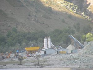
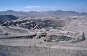
YY: Intensive hydropower here involves two types of geological risk: First, a strong earthquake near these facilities can cause major damage and spark off secondary disasters.
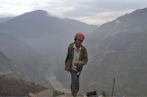
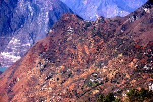
The Jinsha and its tributaries flow through the Sichuan-Yunnan fault zone, with some stretches of the river running parallel to or along the fault lines. The area is one of high mountain valleys, with fragmented geology and many unstable cliffs.
Second, the region’s complex and active geology means reservoirs behind the dams will spark stronger and more frequent earthquakes.
Recent years have seen a period of geological activity. There would be earthquakes here even if it wasn’t for the dam reservoirs. But, the reservoirs may result in more powerful levels of stress. Scientists still don’t fully understand those processes, and we can’t understand or control them.
Construction plans for hydropower dams in the Hengduan Mountains [on the Yunnan-Sichuan border] have overlooked how rivers can become blocked in such geologically active zones.
Given the history of earthquakes on the Jinsha, and based on my own research, let’s look at what might happen if there was an earthquake of magnitude 7 or 8 on the Jinsha.
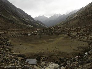
Risks include multiple landslides upstream at the Tongjia Gorge, forming two or three barrier lakes. Hillsides on the Batang-Benzilan River stretch could collapse, making many old landslide sites active again and forming a string of barrier lakes. The generators and transmission equipment of hydropower plants would be badly damaged.
The river would be blocked again at Tiger Leaping Gorge due to landslides, with transmission equipment at Ahai and Ludila badly damaged.
There may be further landslides at Wudongde downstream, with old landslide sites further downstream becoming active again. Blockages could cause river water to back up towards the dam, with generating equipment and buildings badly damaged by landslides.
There could also be a number of landslides at Xiluodu, with the dam severely tested by uncontrolled releases of water from other dams and barrier lakes.
LQ: Under what conditions does hydropower development give rise to earthquakes?
YY: It depends on the geology of the reservoir area, how those structures formed, the size of the reservoir, and how it is operated.
A global analysis of almost 2,000 reservoir earthquakes showed that the depth and capacity of reservoirs plays a clear role in the physical processes that cause earthquakes. The direct stress caused by the weight of the reservoir is nowhere near enough to affect intact rock. But if the rock is not intact and cracks form, and if the pressure of water forced into those cracks is high enough, the shearing stress and water pressure can contribute directly to earthquakes.
It’s like a balloon that remains stable, or slowly deflates, when there are no external pressures. But when there is external pressure, such as from a needle, it suddenly bursts. Reservoir earthquakes are like that needle. You can’t assume all reservoir earthquakes will be small.
There are no cases of a reservoir causing a magnitude 7 or above earthquake. But there have never been so many dams built in such a geologically stressed region.
Rivers in the region follow the active fault-lines. Inevitability, this means dams will be built on the faults, and those faults cause earthquakes.
As the rivers in the Hengduan mountains are largely seasonal, their reservoir water levels are frequently changing to absorb floodwaters or alleviate dry periods. These rapid changes can affect stability of the sides of the reservoir, and may cause stresses that trigger earthquakes.
LQ: There is no sign of hydropower development slowing in the south-west and on the Qinghai-Tibet Plateau. Is hydropower the best way to solve China’s power shortages?
YY: At the end of 2012 China had installed 1,060 gigawatts of electric generating capacity – overtaking the US to become the world’s largest power generator. But China’s GDP is only about 30% of that in the US, meaning that China consumes much more power per unit of GDP. China’s GDP energy intensity is 7.5 times that of Japan, 5.5 times Germany, 4.4 times the US, 3.5 times Australia and even 2.5 times that of Brazil.
This means that deeper reform and structural adjustments, as well as eliminating inefficient production, will allow China to develop on its existing power capacity for some time. Hydropower development on the Jinsha and in the south-west in general can slow down, to allow time for further research and planning, which in turn will mean we can avoid unnecessary risks.