From a global environmental perspective, few places in the world are as important as Tibet. Rising concerns about global warming, climate change, receding glaciers, desertification, food insecurity and loss of biodiversity all point to the significance of Tibet. Tackling these important issues requires greatly increased scientific research in Tibetan areas and improved understanding of current land use practices, especially of agriculture, forestry and livestock grazing. Critical examination of existing environmental conservation and economic development policies and new thinking on how we view the Tibetan landscape are required.
In this article, I use the term "Tibetan Plateau" to refer to a unique geographical area of Asia; a landscape not marked by lines drawn on a map, but defined by topography. It is a region with particular geological, ecological and socio-cultural characteristics. Tackling global environmental challenges in the twenty-first century demands that we view the Tibetan Plateau holistically to understand its unique ecology, its natural resources and illustrious cultural heritage.
Encompassing an area of about 2.5 million square kilometres, or about one-third the area of the continental United States, the Tibetan Plateau is the largest and highest region on Earth. With an average elevation of 4,500 metres above sea level, the Tibetan Plateau stretches for almost 3,000 kilometres from west to east and 1,500 kilometres from south to north. The Plateau is ringed by high mountains – the Himalayas to the south, the Karakorum in the west and the Kunlun across the north. The Tibetan Plateau goes beyond political frontiers and encompasses much of the higher elevation Himalayan regions in Pakistan, India, Nepal and Bhutan as well as all of the Tibetan Autonomous Region, Qinghai, western Sichuan, northern Yunnan, western Gansu and southern Xinjiang Uyghur Autonomous Region in China.
I have a plastic, raised-relief map of China in which the Tibetan Plateau and adjoining mountain ranges stand out clearly. It depicts the vast area encompassed by the plateau and the abrupt uplift of the Himalaya rising from the plains of northern India. Looking at this map you can see how the Tibetan Plateau dominates the geography of Asia.
Photographs taken by astronauts at heights of 200 to 400 kilometres above the earth also provide an out-of-the-ordinary observation of the Tibetan Plateau. Unhindered by the clutter of political boundaries, the land is defined by watersheds, by mountain ranges and large lakes; the natural demarcations of an environment.
These views from space provide a perspective that helps one to think globally and to see the landscape in its entirety. Environmental conservation strategies for the Tibetan Plateau need to encompass a broad scale and implement programs at the level at which natural systems operate. This landscape level of attention ensures persistence of populations and ecological processes and has to work across political boundaries. Man-made lines on a map do not stop a river from flowing downhill nor do they prevent black-necked cranes from migrating or Tibetan argali and Tibetan wild ass from crossing international borders in search of forage. Birds and animals travel across the earth and we need to adopt a similar style in how we perceive landscapes.
The American poet Gary Snyder wrote, “Now, with insights from the ecological sciences, we know that we must think on a scale of a whole watershed, a natural system. A habitat. To save the life of a single parrot or monkey is truly admirable. But unless the forest is saved, they will all die.” Saving the Tibetan Plateau requires an approach that recognises watersheds to define plans of action for conservation and development. It also requires acceptance of the complex nature of the Tibetan landscape, not only in the physical forces that shape it, but also in the interaction of socio-economic and institutional forces that impact the nomads and farmers who use the natural resources.
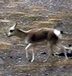
The Tibetan Plateau plays an important role in global climate change. With its extensive alpine grasslands that store carbon in their plants and soil, the Plateau is a significant carbon pool. The carbon stored in the grassland ecosystem is important to regional and global carbon cycles; it has the potential to modify global carbon cycles and influence climate. What takes place in the Tibetan grasslands therefore should be of increasing importance to a world more and more concerned about climate change.
With thousands of glaciers scattered across the Plateau and the Himalayas, the region has the most snow and ice outside of the polar regions. The glacier-fed rivers originating from the Tibetan Plateau make up the largest river run-off from any single location in the world. With global warming, the total area of glaciers on the Tibetan Plateau is expected to shrink by 80% by the year 2030. The loss of these glaciers will dramatically affect major rivers that provide water for more than one-third of the world’s population. The effect of glaciers receding will be felt well beyond the borders of the Tibetan Plateau, with profound impacts over a wide area in Asia and great risks of increased poverty, reduced trade and economic turmoil. This presents major political, environmental and socio-economic challenges in the years ahead.
The Tibetan Plateau forms the headwaters environment where the Yellow, Yangtze, Mekong, Salween, Brahmaputra, Ganges, Sutlej and Indus rivers originate. In addition, rivers from the northern edge of the Tibetan Plateau flow into the Tarim Basin and the Gansu Corridor, providing precious water for the oasis towns along the old Silk Road. The management of these river source environments has global implications, as the water from their watersheds will be of increasing importance in the future. The water they provide is critical to the survival of millions of people downstream. The recent floods in the Indian states of Bihar and Assam draw attention to the critical role of the Tibetan environment in regulating water flow to downstream areas. How many people realise that the Kosi River, which recently flooded and displaced millions of people in the northern Indian state of Bihar, actually has its origins on the north side of Mount Everest? Or that almost 60% of the total length of the 2,906 kilometre-long Brahmaputra River that floods India and Bangladesh every year is located in Tibet? Simply for the water that it provides, the Tibetan Plateau demands greater attention.
NEXT: Protecting biodiversity on the Tibetan Plateau
Daniel J Miller is a rangeland ecologist and agricultural development specialist with over 15 years professional experience in agricultural development, natural resource management and biodiversity conservation in Asia. He has worked in Bhutan, China, Mongolia, Nepal and Pakistan and has traveled widely throughout South and South-east Asia. He speaks Nepalese, Tibetan and some Chinese.
The views and opinions expressed in this article are those of the author and may not necessarily reflect those of the US Agency for International Development or the US Government.
Homepage photo by Daniel J Miller