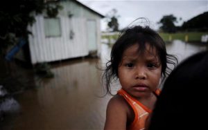
Flooded streets on a daily basis are more than just a scary future scenario for many cities along the US East Coast. In Norfolk, Virginia, they are the reality today. In the neighborhoods around Myrtle Park where the Lafayette River forms a U shaped bay, residents regularly report that they can see fish swimming in the street curbs.
So when the Union of Concerned Scientists released its recent report on the expected increase in tidal floods in 52 cities along the Atlantic and Gulf coasts, this was hardly a surprise for Skip Stiles, a Norfolk resident and director of the non-profit Wetlands Watch. “Just this summer, there were four occasions on which the city had to basically shut down until the water had drained off the land. Kids couldn’t get to school and you couldn’t make it from one side to the other.”
Experiences like these heighten the sense of urgency in coastal communities to act now rather than face the consequences later. Norfolk, a city of 250,000, home to the US Navy’s second fleet and the world’s largest naval base, is struggling to keep the water at bay by elevating roads and building storm surge gates. Many residents find it increasingly difficult to procure flood insurance for their homes. Stiles works with authorities to make sure that new developments are not built on flood-prone land – and that building plans leave enough open space and green infrastructure.
Further down the coast, Florida’s vacation paradise Miami is often seen as ground zero for the real life effects of climate change. In a 2013 report by Nature Climate Change identifying the cities at the greatest economic risk of flood losses, Miami was ranked second only to Guangzhou.
The high tides earlier in October were a test for several newly installed storm pumps in Miami’s sister city Miami Beach with a capacity to pump 50,000 gallons of water per minute back into the bay. The city is built on porous limestone, allowing floodwater to seep into the ground and resurface inland. The trial run ended with a success. Apart from some brief road flooding and some puddles around the drains, the streets in South Beach remained mostly dry.
Over the next five years, Miami Beach plans to spend at least US$300 million on about 60 pumps to upgrade a drainage infrastructure that was built more than half a century ago. This summer, a Sea Level Rise Task Forcerecently urged the Miami-Dade county government to increase its investments in flood control in the face of predictions that flood insurance losses in Southeast Florida, a region that is home to 5.7 million people, could reach US$33 billion – or 10 percent of GDP – by 2030.
The task force report called it an “economic imperative” to create an adaptation plan if the region did not want to risk its “insurability and financial support in the future”. Efforts to get things going are well underway: The Southeast Florida Regional Climate Change Compact, a partnership between several counties and non-profit organisations sharing resources and experience, is seen as an effective model for coordinating the response to climate change at a local level.
“Having a structure like this has made it easier for some federal and state resources to flow to the region,” says Chris Bergh of The Nature Conservancy’s Florida Chapter, one of the Compact’s partners since its founding in 2010. “And our annual summits keep local actors aware and involved.”
The region around Miami can rely on many years of direct experience with rising sea levels. Others are newer to the discussion. The US capital Washington D.C. has to expect up to 400 floods a year by 2045, according to the UCS report, making it the city with the highest increase in tidal floods.
The number aligns with the dire forecast in a report issued by Climate Central in September: At a predicted sea level rise of 2 to 4 feet on the Atlantic Coast, a big storm blowing up the River Potomac in the year 2100 could easily reach 8 feet and inundate the memorials on the National Mall as well as three military bases – let alone more than 1,000 private properties at a value of more than $6 billion.
For the first time, the city has hired a team of consultants to help protect private property, government buildings and cultural sites. The Pentagon is conducting its own assessment of the vulnerability of its facilities by flooding events.
While many communities are still assessing the funding needs, the city of New York came up with a staggering number in the adaptation plan then-Mayor Michael Bloomberg presented in the summer of 2013. The city wants to spend US$19.5 billion on boosting its defenseswith a large network of sea walls and levees – not unlike the system installed in New Orleans after Hurricane Katrina. And just as in the case of New Orleans, New York hopes to pay for its plan in big parts with federal relief funds it received in the aftermath of Hurricane Sandy.
But despite all the plans to brace against higher tides, New York has so far resisted suggestions from scientists and engineers to build a massive, eight kilometer long, storm protection barrier across the New York Bay – similar to an even longer structure off the coast of Saint Petersburg. The city is using US$335 million that the federal government has awarded for a plan to build a 19 foot high berm with parks and promenades around Manhattan, but is holding off on another idea to reclaim land and build a multi-purpose levee that would combine flood protection with commercial use.
Maybe that is no wonder. After all it is the water that makes a coastal city attractive – and many in Lower Manhattan would rather not have a wall of high-rise buildings block their view across the East River.